| Description: |
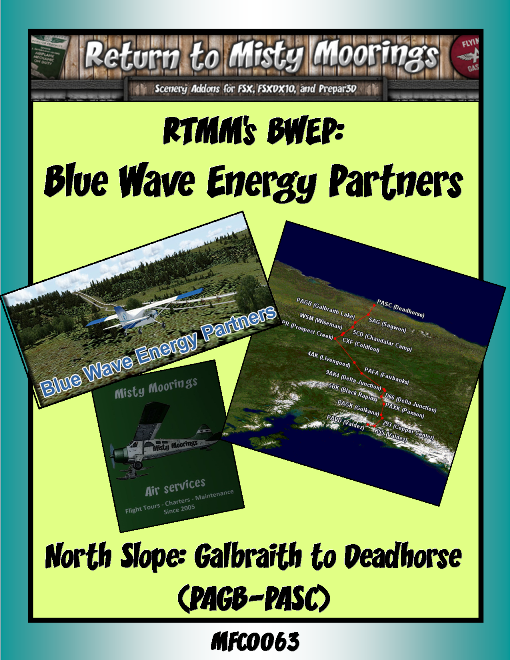
MFC0063 BWEP North Slope (PAGB to PASC)
This is the sixth BWEP segment: MFC0063 BWEP North Slope (PAGB to PASC).
The far northern reaches of Alaska are truly one of the reasons why this state is nicknamed "The Last Frontier" and the North Slope is like no other place on earth. It conveys a silence, beauty and refuge like no other. The land's topography is characterized by vast, uninhabited gently rolling tundra and wild, desolate and quiet landscapes where seemingly endless vistas stretch out until it ends at the sea. The breathtaking beauty of Alaska sometimes hides the fact that its landscape is dangerous and unforgiving - even in the warmer months. Its winters can be incredibly harsh, especially so for those who live and work in the state's most desolate areas.
Located at the northernmost reaches of the Pan American Highway, Deadhorse and Prudhoe Bay sit 3mi/5km apart on the coast of the Arctic Ocean at the heart of Alaska’s oil patch. Deadhorse is more of a work camp than a town in the traditional sense. It was established to support oil development in the surrounding area. Most buildings are the modular, pre-fabricated type, situated on gravel pads on tundra bog. Virtually all the businesses are engaged in oil field or pipeline support such as drilling, construction and maintenance.
The North Slope region contains: the National Petroleum Reserve in Alaska [NPRA] - the largest tract of undisturbed public land in the United States and the Prudhoe Bay Oil Field – the largest oil field in North America, discovered in 1968, as well as the Kuparuk River Oil Field, discovered in 1969, which is the second largest oil field in North America. The region also includes the Arctic National Wildlife Refuge, which has been the center of great controversy because of the possibility of petroleum drilling within its boundaries. The Trans-Alaska Pipeline System [TAPS] begins here and makes it way south for 800 miles to its terminus in Valdez.
Aircraft: Again a “low and slow” single engine prop fixed wing: DHC-2 Beaver, Maule M7, C185, C140, C170, C17, C182, C206, C207, PC-6, PA-18 Super Cub etc, and if running in winter season perhaps you might want to add ski-wheel or tundra wheels. These make great aircraft to use in this exploration tour. There are BWEP liveries on the RTMM BWEP page, (RTMM’s Klaus Tröppner has also created some great BWEP repaints for these designated aircraft). (This trip, again is not long in entirety it does have some longer legs so expect I’ll run the Pilatus PC-6 which is almost a STOL type aircraft. But as always, please feel free to use the aircraft of your choice). The idea here is to run as low and slow as possible to be able to see the various scenery locations and to be able to follow rivers and the “pipes”.
For the helo pilots - specifically helicopters operated by the BWEP: refer to Klaus Tröppner’s Helicopter repaints: These include BWEP liveries of the following models that you can fly in this tour: Erickson S64, Bell212, Bell412, AS332, Bell 206, Bell 222 or the MD530.
Hope you enjoy the trip following the pipes and visiting most of the RTMM/BWEP poi’s in this rugged area.
Tour Flight Leg Rating Conditions: IE: “6A0” or 6A1, 6A2 etc:
6=Max landing rate is -600fpm,
A=Autopilot and/or GPS use permitted: (but not recommended).
1= # of Stop-overs in the flight leg* IE: 1 = One stopover in the flight leg.
The Tour download for this excursion is available in the Tour downloads section which contains the all the tour details, scenery requirements, stop-over locations, flight plans, sky vector map links as well as the award for completion so make sure you obtain the tour download for all of the tour specifics.
|
| Allowed Aircraft Types: | @SEL, A-1C, A42, A5, AC50, AN2, AS65, B205, B206, B212, B350, B407, B412, B5, B58, BDOG, BE33, BE35, BE36, BE58, BL8, BN2, BT67, C-64, C130, C140, C152, C170, C172, C182, C185, C195, C206, C207, C208, C310, C337, C414, C421, C46, C47, C60, C701, CAT, CH47, D17S, D18S, DA40, DA62, DC3, DC6, DHC1, DHC2, DHC3, DHC4, DHC6, DHC7, EC35, EC45, F-13, G111, G21, G44, G73, H225, H500, H530, J3, JU52, K100, L10, M20R, M7, MK35, MU2, O1, P149, PA18, PA24, PA28, PA30, PA34, PA44, PC12, PC6, PZ04, RV14, S300, S64, SH36, SIRA, SP7, T206, UH60, V431, XCUB, XNXC, XSVC, XVGR, ZLIN |