| Description: |
MFC0067 Coastal Alaska-Gulf of Alaska-North Pacific-Kulik Lake to Cordova
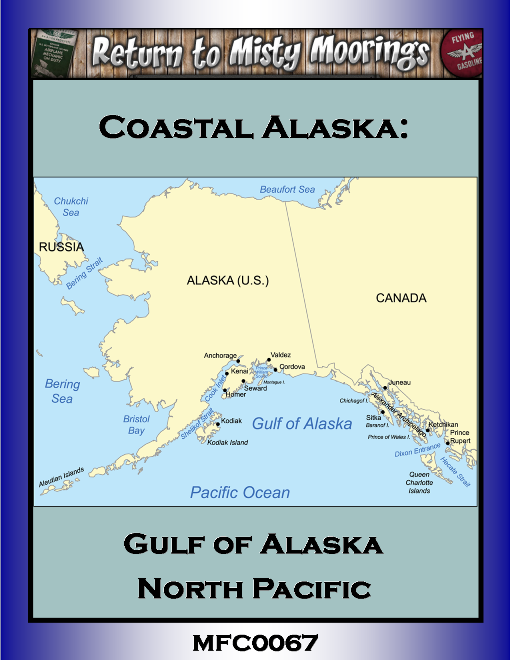
The Gulf of Alaska is an arm of the Pacific Ocean defined by the curve of the southern coast of Alaska, stretching from the Alaska Peninsula and Kodiak Island in the west to the Alexander Archipelago in the east, where Glacier Bay and the Inside Passage are found.
The Gulf shoreline is a rugged combination of forest, mountain and a number of tidewater glaciers. Alaska's largest glaciers, the Malaspina Glacier and Bering Glacier, spill out onto the coastal line along the Gulf of Alaska. The coast is heavily indented with Cook Inlet and Prince William Sound, the two largest connected bodies of water. It includes Yakutat Bay and Cross Sound. Lituya Bay (a fjord north of Cross Sound, and south of Mount Fairweather) is the site of the largest recorded tsunami in history. It serves as a sheltered anchorage for fishing boats. We’ll explore some of this area as well as a few of the glaciers.
The Excursion:
This is intended to be a low level coastal flight excursion for MSFS but also works in FSX-P3D. In FSX-P3D might have to tweak an airport ICAO or two to match the sim’s airport table but the flight plans will direct you to the locations of the intended airports.
Aircraft:
There is a mix of land and water landings so an amphibious craft is required.
SIM:
MSFS/FSX/P3D.
Time/Weather:
Dawn or Dusk are the nicest times to fly and can yield very pretty and interesting lighting effects). If possible try live time and live weather. If not possible set your own weather and time parameters and enjoy the scenery.
Add-on Scenery:
Refer to the Add on Scenery folder in the tour download. (Imperative for this trip).
Tour download for this MFC0067 excursion is available from the download section and contains documentation, flight plans (.pln) for FSX/P3D/MSFS, LNM as well as static sky-vector maps links for each leg for those seeking a navigational challenge in negotiating the route by way of dead reckoning and marking position/landmarks. Refer to the flight plan and Cigar Box notes for intermediate stopover locations.
Tour Flight Leg Rating Conditions: IE: “6A0” or 6A1, 6A2 etc:
6=Max landing rate is -600fpm,
A=Autopilot and/or GPS use permitted: (but not recommended).
1= # of Stop-overs in the flight leg* IE: 1 = One stopover in the flight leg.
|
| Allowed Aircraft Types: | @SEL, A-1C, A42, A5, AC50, AN2, AS65, B205, B206, B212, B350, B407, B412, B5, B58, BDOG, BE33, BE35, BE36, BE58, BL8, BN2, BT67, C-64, C130, C140, C152, C170, C172, C182, C185, C195, C206, C207, C208, C310, C337, C414, C421, C46, C47, C60, C701, CAT, CH47, D17S, D18S, DA40, DA62, DC3, DC6, DHC1, DHC2, DHC3, DHC4, DHC6, DHC7, EC35, EC45, F-13, G111, G21, G44, G73, H225, H500, H530, J3, JU52, K100, L10, M20R, M7, MK35, MU2, O1, P149, PA18, PA24, PA28, PA30, PA34, PA44, PC12, PC6, PZ04, RV14, S300, S64, SH36, SIRA, SP7, T206, UH60, V431, XCUB, XNXC, XSVC, XVGR, ZLIN |